Warning for drivers over severe weather
28 June 2021, 7:18 AM
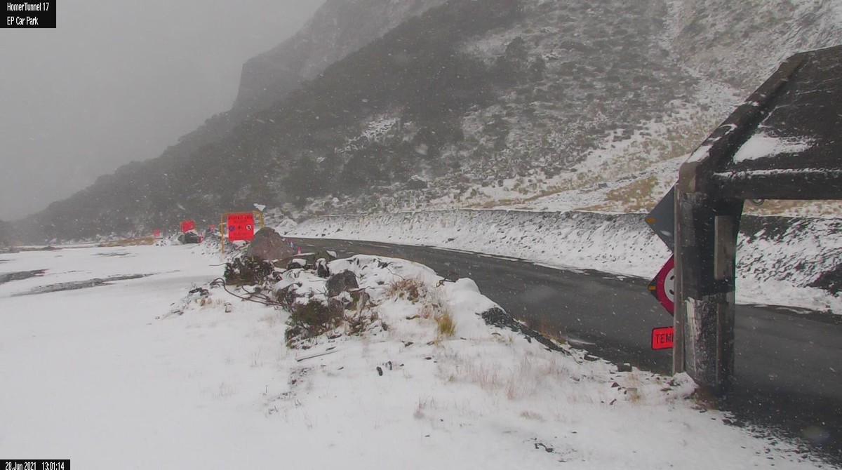 Milford Road this afternoon, 1pm
MetService has issued a number of severe weather warnings for the next few days.
Heavy snow and severe winds have been predicted for both the North and South Islands.
Bitterly cold conditions across much of the South Island are expected as well as snow affecting many roads and passes making driving conditions hazardous.
A MetService Heavy Snow Watch is in place for Southland, north of Nightcaps and east of Wyndham, Dunedin, Central Otago and Clutha, until 3am tomorrow.
Advertisement: Todd Real Estate

Snow is expected to fall down to 100m, heavy at times, with snow accumulations potentially reaching warning criteria above 200 metres.
Heavy rainfall and snow is also predicted for Lewis Pass (SH7), Arthur’s Pass (SH73), Lindis Pass (SH8), Crown Range Road, Milford Road (SH94), and the Dunedin to Waitati Highway
Strong winds are expected in Fiordland, south of West Cape, Southland and Stewart Island, as well as in the North Island.
The Milford Road closed at 4.30pm today until tomorrow at the earliest.
Advertisement: Southern Mobility

"Police recommend staying off the roads during severe weather conditions but if you do have to travel, first check to see if your journey has been impacted," a police spokesperson says.
The Waka Kotahi (NZ Transport Agency) website and App advises road closures and provides real time traffic updates.
"If the weather is bad and your travel can’t be put off, allow extra time for your journey."
"Roads can become icy and slick when it’s cold so remember to increase the following distance between you and the car in front to ensure you have enough time to stop safely.
Advertisement: Radhas

"When you’re on a wet, icy, or snowy road, it’s important not to brake suddenly or to accelerate quickly, as you could aquaplane or skid.
"Plan to drive in the middle of the day or in daylight hours, when visibility is better and ice and snow are less likely to be on the road.
"Avoid driving at night, when hazards rapidly multiply.
"In these situations, more than ever, driving to the conditions is crucial.
Advertisement: Kennedy School of Music

"Slow down to arrive alive."
At 4pm this afternoon, the Highways South update states: "Showers are presently concentrated in a band from roughly Colac Bay, across to Otautau - Dipton - Hokonui Hills and then up into Tapanui, and are fairly widely scattered in other areas.
"Temperatures are still plenty cold enough to be creating snowfalls to around 300m, but obviously snow accumulations are only taking place where the heaviest and most persistent showers are.
"Satellite images still show quite a lot of shower activity yet to come in, and snow levels are not expected to start rising until tomorrow.
"Showers bands will no doubt shift around the region during the night, so there is still a risk of snowfall affecting higher roads between now and about 9am tomorrow morning. Isolated local heavy hail showers may result in some hail accumulation to sea level."
More information about preparing for severe weather:
- MetService - www.metservice.com/warnings
- Get Ready NZ - https://getready.govt.nz/emergency/storms/
- Get Thru - https://getthru.govt.nz/storms
- Civil Defence - https://www.civildefence.govt.nz/resources/what-to-do-during-a-storm/