UPDATED: Dunedin declares state of emergency, SH 1 Waihola-Milton closed
03 October 2024, 10:41 PM
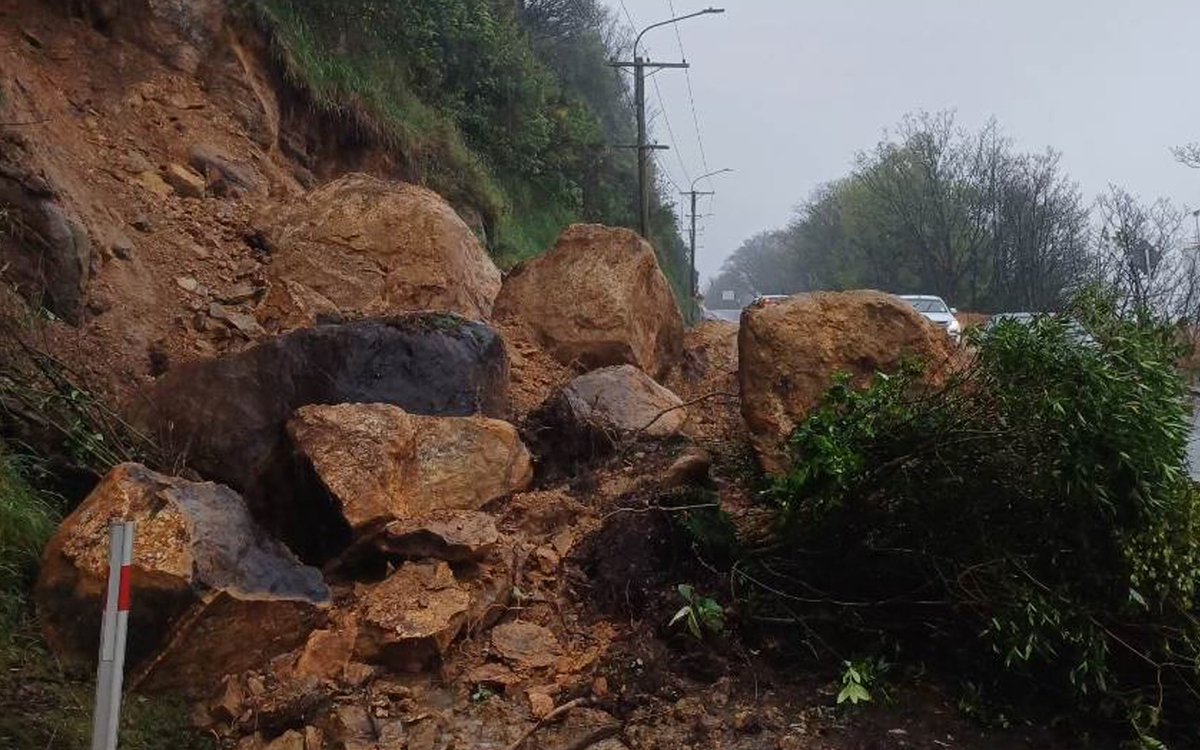 A slip closes SH88, Dunedin to Port Chalmers this morning. Photo: NZTA
Dunedin has declared a state of emergency as heavy rain continues to lash Dunedin, Otago and Southland.
FENZ staff have been responding to the emergency, including mobilising an Urban Search and Resue team from Christchurch, with included a specialist drone team.
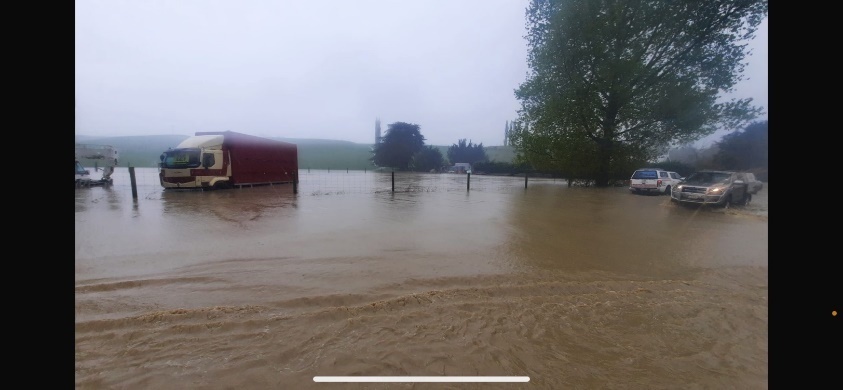
Waikouaiti this morning. Photo: NZTA
State Highway 1 Waihola to Milton and Evansdale to Palmerston have now also been closed, along with State Highway 85 Palmerston to Kyeburn. In Southland the Otautau Bridge has been closed while numerous other roads have either surface flooded or been closed.
NZ Transport Agency Waka Kotahi (NZTA) is urging drivers to stay home unless travel is absolutely essential and they know their route is passable and safe.
People should also remeber rivers and streams can rise fast and catch people out and surface flooding can occur quickly making it hard to judge the road surface, with potholes forming fast.
Otago Emergency Management has said a second rain peak is expected mid-afternoon (4 Oct), continuing well into the evening.
NZTA Journey Manager Tresca Forrester said while NZTA crews would be getting out warning signage as fast as they could or closing roads as needed for significant flooding, drivers need to slow down and avoid creating bow waves for nearby properties if they strike patches of surface water.
“Our crews are inspecting the network, including bridges and ensuring any urgent potholes will be managed as water recedes,” he said
Meanwhile in Southland, in a precautionary move, Environment Southland has closed the Otautau Bridge on the Main Street of Otautau.
Rain/Flooding update for state highways in Southland:
All state highways in Southland are open, the team are monitoring river levels and surface flooding - updates will be sent if required. There are currently have patches of surface flooding in these areas:
- SH6 Lumsden-Dipton highway at Bell Road intersection north of Dipton
- SH6 Kingston-Garston highway near Kingston
- SH94 Waimea highway north of Mandeville
- SH96 Winton-Hedgehope highway at Brown Road
- SH97 Mossburn-Five Rivers Road near Acton Downs Road
- SH97 Mossburn-Five Rivers Road near Selbie Road
- SH99 Orepuki-Riverton highway at Stick Road
- SH99 Tuatapere-Orepuki highway at Block Road
ROAD CLOSURE:
The road closure on SH6 near Lowther (between Mossburn-Five Rivers Road and Lowther Road) remains closed from 6.30am-6.30pm daily until Monday 7th October.
All vehicles detour via Mossburn-Five Rivers Road and Mossburn-Lumsden highway.
SH6 will re-open each night at 6.30pm until 6.30am the following morning with a 30km/hr speed limit.
CLICK HERE for Gore District road closures.
CLICK HERE for Southland District road closures
CLICK HERE for State Highway closures
CLICK HERE for the latest Southland High River Watch information