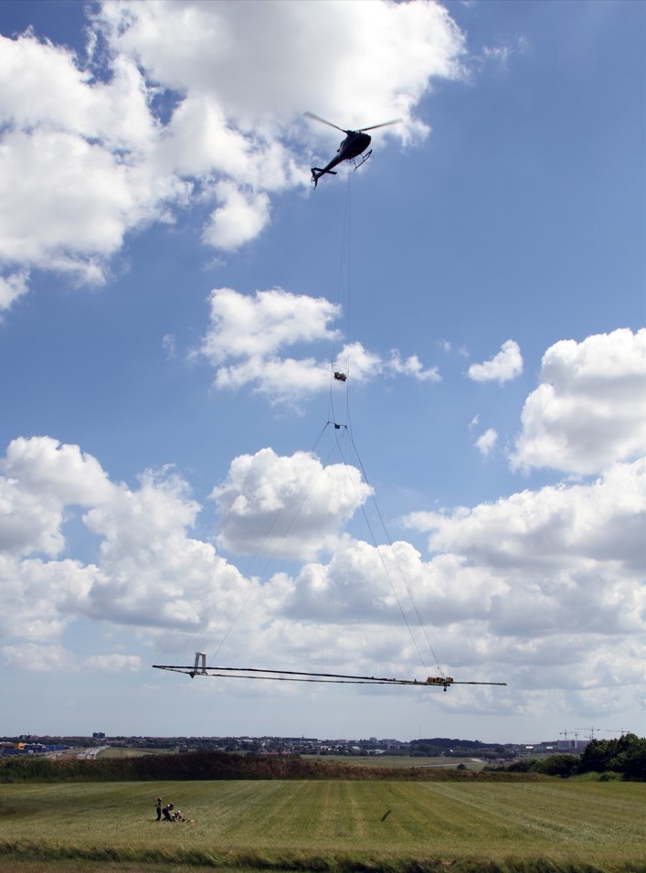
Strange helicopters in the skies?
Paul Taylor
26 October 2022, 11:18 PM
 SkyTEM's airborne electromagnetic technology in action
Low-flying helicopters towing electromagnetic signal loops below them will soon be in the skies above northern Southland.
But don't worry, it's not something out of the X-Files.
Environmental Southland and Aqua Intel Aotearoa have commissioned a company called SkyTEM to conduct the first aerial survey of the ground water of the area.
It will map the aquifers in northern Southland, covering parts of the upper Oreti and Mataura River catchments, using airborne electromagnetic technology (AEM).
Transmitters on the loop under the helicopter send electromagnetic signals up to 300m underground, and sensors measure the behaviour of the returning signals - similar to radar.
AEM has been used commercially since 2004 to map large aquifer systems in countries including Denmark, Netherlands, India, USA, Canada, Australia and New Zealand.
An Environment Southland spokesperson says the project won't present any health risks and is very safe.
"Because the helicopter is moving at high speed, there’s very limited exposure to the electromagnetic signals. It’s safer than watching a plasma or LCD TV or blow-drying your hair."
It's also safe for animals, although pilots will avoid flying over stock and also building up areas.
"Experience in other farming areas is that stock generally aren’t disturbed much by the technology. In New Zealand the team has observed that horses moved to the other side of the paddock when the system came very near."
The AEM technology has been used recently in Hawke’s Bay, Waikato and to survey the Aupōuri aquifer in Northland.

The helicopter will fly at 80-120 km per hour in parallel lines, generally 200 metres apart and at a height of around 100 metres. The measurement instruments are suspended under the helicopter and will be about 30 to 50 metres above the ground.
The noise should be the equivalent to a truck going past on a motorway and lasts for around two to four minutes. The helicopter flies up and down in lines so, once it flies over, it will then return about 15 minutes later but be at least 200 metres further away.
"We will not be gathering data or information on anything above ground. While the helicopter will carry a camera, this is only to guide the crew managing the loop, and no photos or video are retained or shared," the spokesperson said.
The project will run in November and December.
The information gathered by the helicopter and loop will take some time to process and analyse. Once available, it will provide a much better picture of the underground water resource and reduce uncertainty to help guide decisions for environmental protection, development, resource consents, water management, and water availability for the local community. It will be available to councils, tangata whenua, and community groups, subject to agreed guidelines.
"We want to assure you that these flights are not in any way used for compliance monitoring. We only want to know about water," the spokesperson said.
If you have any queries about the surveying work get in touch with Aqua Intel Aotearoa – [email protected] or Environment Southland directly on [email protected]
NEWS
ACTIVITIES & ATTRACTIONS


