Little change in Southland's water quality
Environment Southland
27 September 2020, 2:41 AM
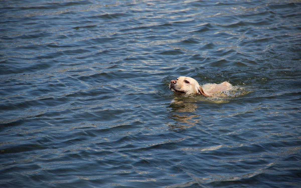 PHOTO: Harry Cao/Unsplash
An annual refresh of water quality data on the LAWA (Land, Air, Water Aotearoa) website reveals that in Southland there has been little change in water quality over the last 10 years. This mirrors the national picture.
Today (Sunday, September 27), marks World Rivers Day, and to acknowledge the occasion water quality data from all regional councils has been updated on the LAWA website.
Environment Southland chief executive Rob Phillips said data highlights the challenge we have in front of us to turn things around. A lot of work was being done to make change, but significantly different approaches to how we manage our environment were needed.
Advertisement
Advertise on the Southland App
“Getting the improvements we all want for water quality will take time. We’re well underway with the People, Water and Land programme, which encompasses on-ground actions and regulation to ensure the changes and investment everyone is making gets the improvement we want to see.”
This year LAWA has focused on the state of our rivers and streams, compared across four different land cover types and how water quality has changed over time. Southland’s results align with the national picture where water quality is best in rivers and streams running through catchment with native vegetation, and poorer water quality coming through pasture and urban land cover catchments.
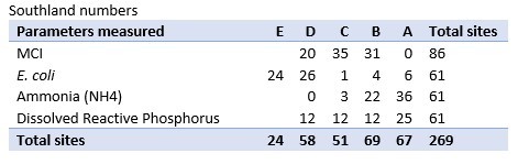
LAWA has assessed four parameters against the National Objectives Framework described in the National Policy Statement for Freshwater Management 2020. Each parameter at each site falls into a band, from A (good) to D or E (poor). The parameters include a biological indicator of ecosystem health (macroinvertebrate community index - MCI), an indicator of safety for human contact with water (E. coli); a nutrient that can be toxic to instream life (ammonia toxicity), and a key nutrient (dissolved reactive phosphorus - DRP) which can lead to problematic algal growth.
In Southland:
• Of the 61 sites monitored for E. coli, just 10 fall into A and B band, suggesting these sites would be suitable for swimming.
• MCI monitoring shows the lowest scores come in the pasture covered land with 17 of the 57 sites in the D band and none in the A band.
• For ammonia toxicity the picture is a little better. None of Southland’s 61 sites fall into the D band, and over half are classified in the A band.
• Dissolved reactive phosphorus results show 40% of sites fall into the A band, with the other 36 sites falling evenly across the B, C and D bands.
“We’re working with farmers, the rural sector, business community groups and other councils to ensure the best decisions are made. It is clear we will all need to do more to improve water quality.
“Last year we asked Southlanders what it is about our waterways that we value. We’ve taken this information and worked with Te Ao Marama (as the environmental arm of Ngai Tahu ki Murihiku) to develop a joint set of objectives and targets for Southland,” Mr Phillips said.
Advertisement

Advertise on the Southland App
This information will be shared over the coming months.
The LAWA project website shows the most up-to-date water quality data for rivers and streams monitored by regional and unitary councils, and National Institute of Water and Atmospheric Research (NIWA). Here New Zealanders wanting to learn about local river water quality can explore the state and trends of monitored waterways in their catchment.
What is LAWA?
LAWA is a collaboration between New Zealand’s 16 regional and unitary councils, Cawthron Institute, and Ministry for the Environment, with support from Department of Conservation and Statistics New Zealand.
This evaluation requires an almost complete history of monthly measurements over the previous five years before a grade can be assigned, so not all sites that feature on the LAWA website can be graded. The ‘current state’ for 2019 at each site is based on data over the last five years (from 2015 to 2019).
Land use is a key driver of water quality and ecosystem health. The analyses show differences in current state for 2019, among four different land cover categories, as defined by the River Environment Classification (REC) system. They are native vegetation, exotic forest, pasture and urban.
What is the People, Water and Land programme?
The programme is about taking the next steps to improve Southland’s water and land. It is a partnership with Te Ao Marama Inc. (as the environmental arm of Ngai Tahu ki Murihiku) and takes a ‘mountains to the sea approach: ki uta ki tai’. The programme’s vision is ‘inspiring change to improve Southland’s water and land’.
FOOD | DRINK